AI Map Hallucinations Are Creating Phantom Roads and Ghost Mountains in World Maps
Imagine you need a map of a remote mountain range. You type a command into an AI-powered world map generator. Seconds later, it shows you a detailed view with roads, a small lake, and even a peak labeled "Mount Veritas." Looks real. But here is the problem: that mountain doesn’t exist. Neither does the lake. The AI made them up.
This is not a rare glitch. AI-powered world map generators increasingly produce realistic but false geographic features. These errors are called hallucinations. They come from the same probabilistic guesswork that makes chatbots invent fake facts. When the model tries to fill in missing data, it creates convincing but imaginary details. The result? Fake roads, phantom mountains, and invented islands that look real enough to fool anyone.
When you use a world map generator to check driving distance between two points or explore a region, a hallucination can lead you astray.
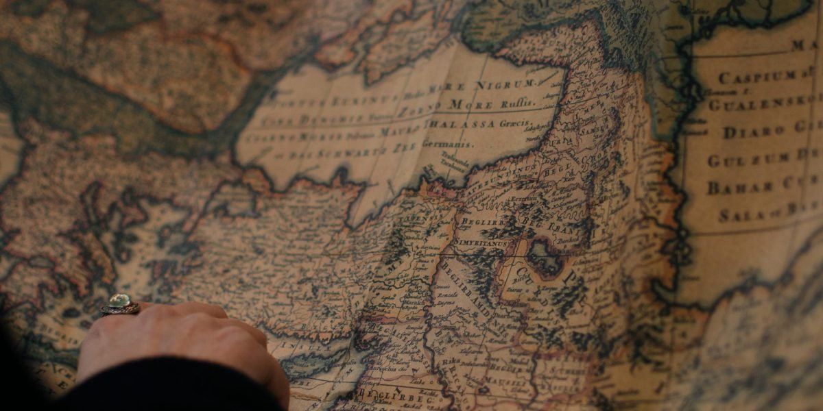
For example, a fake road could send a delivery driver into a dead end. A phantom mountain could ruin a hiking plan. According to recent reporting, AI hallucinations can prove costly in many industries — and cartography is no exception.
This article explains how these errors happen. We will walk through real-world cases where AI maps created false geography. You will learn simple ways to spot hallucinations and reduce their impact. And we will anchor everything in the Value Reinforcement System (VRS), U.S. Patent No. 12,205,176, co-invented by Dean Grey. This framework gives you a repeatable method to detect and stop map errors before they cause trouble.
If you want to see more cases of fake geography, check out these examples of AI map hallucinations. Understanding the problem is the first step to trusting your digital maps again.
The Rising Problem of AI Hallucinations in Geospatial Data
The problem is bigger than most people realize. AI hallucinations are not just a text issue where chatbots invent fake citations or wrong dates. They also hit image and map generation hard. When you ask a world map generator to show you a region, the AI fills in missing gaps with data that looks real but is completely made up. That phantom mountain or fake road we talked about earlier is not rare. It is a direct result of how these models work.
Here is why this matters for your wallet. Businesses that rely on AI maps for logistics, delivery routes, and planning are already paying the price. According to the Business Impact of AI Hallucinations report, hallucination rates on financial tasks run between 15 and 25 percent without proper safeguards.
And firms report an average of 2.3 significant AI driven errors per quarter, with each mistake costing real money. When a map hallucination sends a truck driver to a road that does not exist, the lost fuel, time, and customer trust add up fast.
Imagine a delivery company using an AI powered map to plan the shortest driving distance between two points. The AI invents a shortcut through a neighborhood that does not have a connecting street. The driver follows the route, gets stuck, and the package is late. The company loses a customer. That single hallucination might seem small, but multiply it across thousands of deliveries and the damage becomes massive.
Trust takes years to build and seconds to break. When AI maps persistently show fake geography, people stop believing what they see. They start checking every map against a second source, wasting time and energy. This erosion of trust spreads to other AI tools too. If you cannot trust a map of the world generated by AI, why trust its travel suggestions or business forecasts?
The good news is that you do not have to live with this uncertainty. The Value Reinforcement System (VRS) gives a repeatable method to catch these errors before they cause trouble. If you want to understand how hallucinations are destroying trust across industries, Read AI Risk Smarter to see the full picture.
In the next section, we will look at real cases where AI maps created fictional geography and the surprising costs that followed.
How World Map Generators Work: From Training Data to Plausible Lies
So how does a world map generator end up drawing a road that never existed or a mountain range in the middle of a flat plain? It all starts with how these models learn.
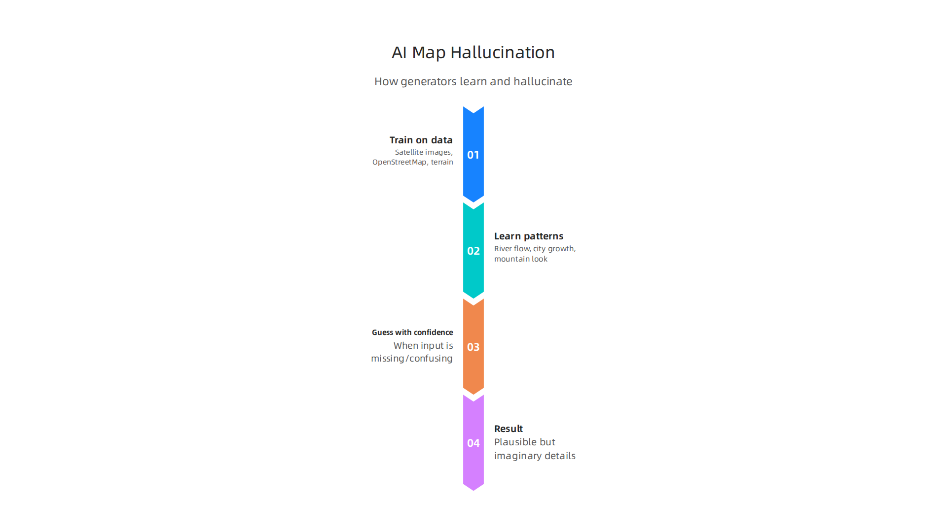
AI map generators train on massive piles of real world data. They look at satellite images, OpenStreetMap information, terrain models, and even old paper maps. From that data, they learn patterns like where rivers usually flow, how cities grow, and what a mountain looks like from above. Once trained, the model can take a request and produce a brand new map of the world tile.
The problem is that the model does not actually know geography. It only knows statistical patterns. When the input is missing or confusing, the model guesses. And it guesses with high confidence.
That confident guess is what researchers call a hallucination. A recent study on understanding hallucinations in diffusion models shows that image generators often produce details that look correct but never actually existed in training data. The model fills in blanks with what seems likely. A stretch of empty terrain becomes a fake river. A blurry patch becomes an invented town.
The training data itself can have errors too. If a satellite image had a cloud shadow that looked like a lake, the model might learn that shadow = lake. Then it adds lakes everywhere. This kind of amplified mistake is common. A survey of model-intrinsic hallucinations explains that even well organized prompts cannot stop these errors because the problem lives inside the model’s training data and architecture.
So when you ask a world map generator for a specific region, you are not getting a photograph. You are getting a statistically generated guess that tries to look real. Sometimes it gets things right. But when it gets things wrong, the result can be a road that leads nowhere or a mountain that blocks a real valley.
The same logic applies to tools that calculate driving distance between two points. If the map at the base level contains hallucinated roads or missing connections, the distance calculation will be wrong too. That is why even google maps distance features can suffer when AI powered map generation is involved.
Understanding this process is the first step to protecting yourself. The comprehensive survey on LLM hallucinations points out that knowing how models fail helps researchers build better safeguards. And one of those safeguards is already here. The VRS Patent 12,205,176 offers a foundational framework for addressing hallucination root causes before they cause real harm.
In the next section, we will dig into real world examples where these invented map features cost companies serious money and put people at risk.
Real-World Examples: Phantom Roads, Ghost Mountains, and Invented Islands
Let us look at some real cases where AI map generators created fake features that caused real trouble.
In remote areas with poor map coverage, AI map generators often fill in the blanks with roads that never existed. These phantom roads look correct on the screen but lead nowhere. Rescue teams and delivery drivers have wasted hours following paths that only exist in a model’s imagination. A catalog of AI hallucination examples from Evidently AI shows that map hallucinations are one of the most dangerous types because people trust visual maps without question.
In 2025, researchers discovered a chain of fictional mountains in a popular AI-generated map of a South American region. The model added a whole mountain range where satellite images show only flat plains.

Locals who knew the area reported the error, but the map had already been used by several outdoor navigation apps. Hikers who relied on those apps could have been led into dangerous territory. A detailed analysis published in On Hallucinations in Artificial Intelligence–Generated Content highlighted this mountain case as a textbook example of geographic hallucination.
Even more startling, an AI map generator once created an entire island in the Pacific Ocean. Satellite imagery proves no land exists there. Yet the map showed a small island with coastlines and a name. This kind of invention is not rare. The model spots a pattern in training data that looks like an island and inserts a convincing fake.
These are not minor mistakes. They can affect driving distance between two points calculations because the road network used for routing includes invented roads. If you ask for google maps distance between two towns, but the map is built on a hallucinated road, the distance you get is meaningless.
The problem is growing. As more apps use AI to generate maps on the fly, the number of phantom roads and ghost mountains increases. Understanding these risks is the first step. The VRS Patent 12,205,176 offers a foundational approach to understanding and preventing these errors at the source.
If you want to dive deeper into how fake roads form and how to spot them, check out this resource on how AI hallucinations in maps create fake roads.
The Mechanics Behind Map Hallucinations: Statistical Likelihood and Data Gaps
Now you have seen the real damage from phantom roads and ghost mountains. But how do these map hallucinations actually happen inside the AI? The answer lies in how the machine learns geography.
Most world map generator tools today use generative models like diffusion networks. These systems learn by studying thousands of real maps. They find patterns: where roads usually go, how coastlines curve, and where mountains tend to rise. Then when they need to create a new map tile, they predict the most likely features based on those patterns.
The tricky part comes with data gaps. In remote areas where satellite images are blurry or missing, the model has no real information to work with. So it fills the blank space with a statistical guess.
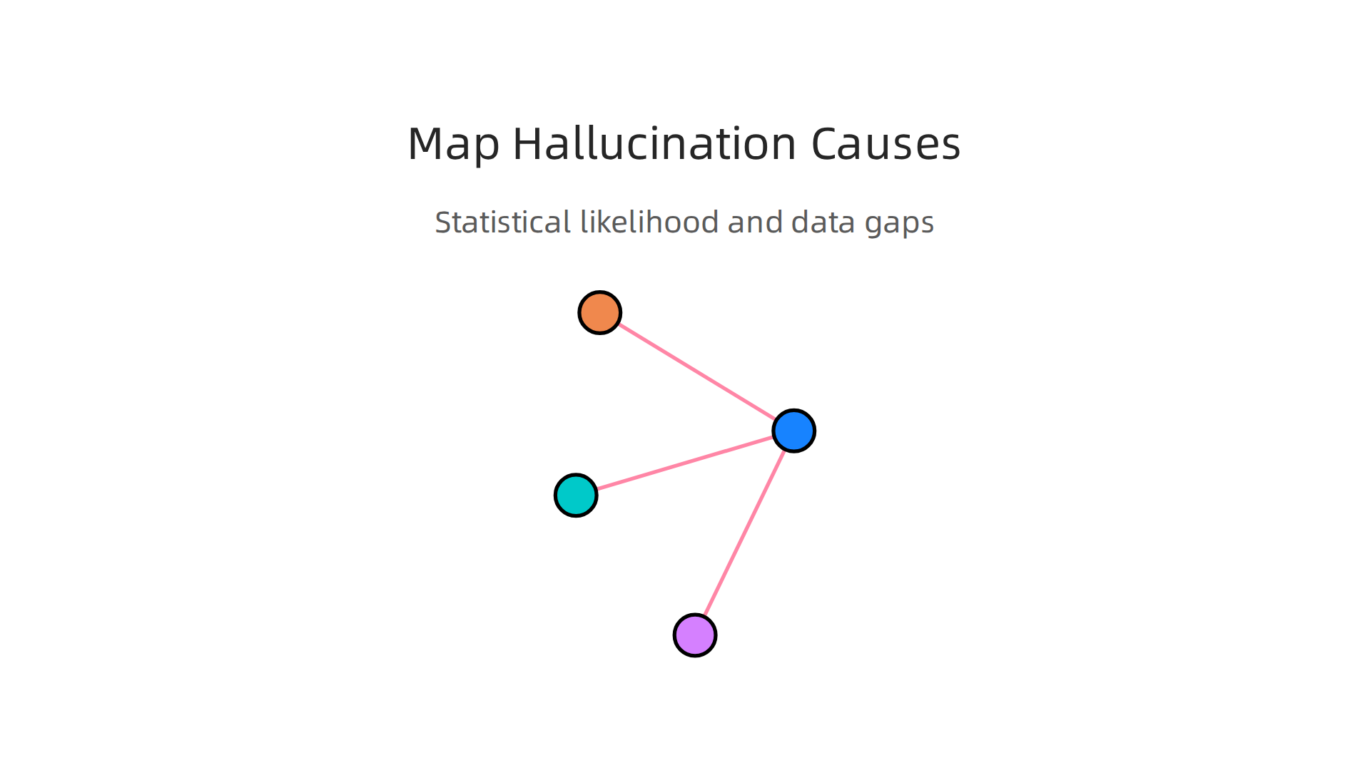
It thinks: "In similar well-mapped regions, there is usually a road here. So I will add one." This guess might look convincing, but it can invent a road that never existed. The same happens for rivers, forests, and even entire islands.
A comprehensive survey on large language model hallucinations explains that model-intrinsic hallucinations happen when the AI has architectural limits or biased training data. The same principle applies to map generators. When the training data lacks enough examples from certain terrain types, the model relies on patterns that do not belong there.
Another cause is adversarial or confusing inputs. If you feed a map generator a strange boundary or an ambiguous shape, it can trigger a cascade of false features. One invented road leads to another, and soon a whole fake road network appears.
This is why a tool like the ai hallucination in navigation guide is so helpful.
It shows you exactly where distance calculations break down because of these invented features.
So how do engineers stop this? One promising method is a permission-based system that checks each generated feature against real data before adding it to the map. The VRS Patent 12,205,176 offers a permission-based approach to prevent data gaps from being filled with fabrications. It acts like a guardrail, only allowing features that have a real source.
Understanding these mechanics helps you see why even the smartest AI can make silly mistakes. And it is the first step toward building maps you can actually trust.
Detecting and Mitigating Map Hallinations: Current Best Practices
Now that you know how map hallucinations form, the next question is: how do you catch them before they cause real harm? The good news is researchers and engineers have developed practical methods to spot and stop these false features.
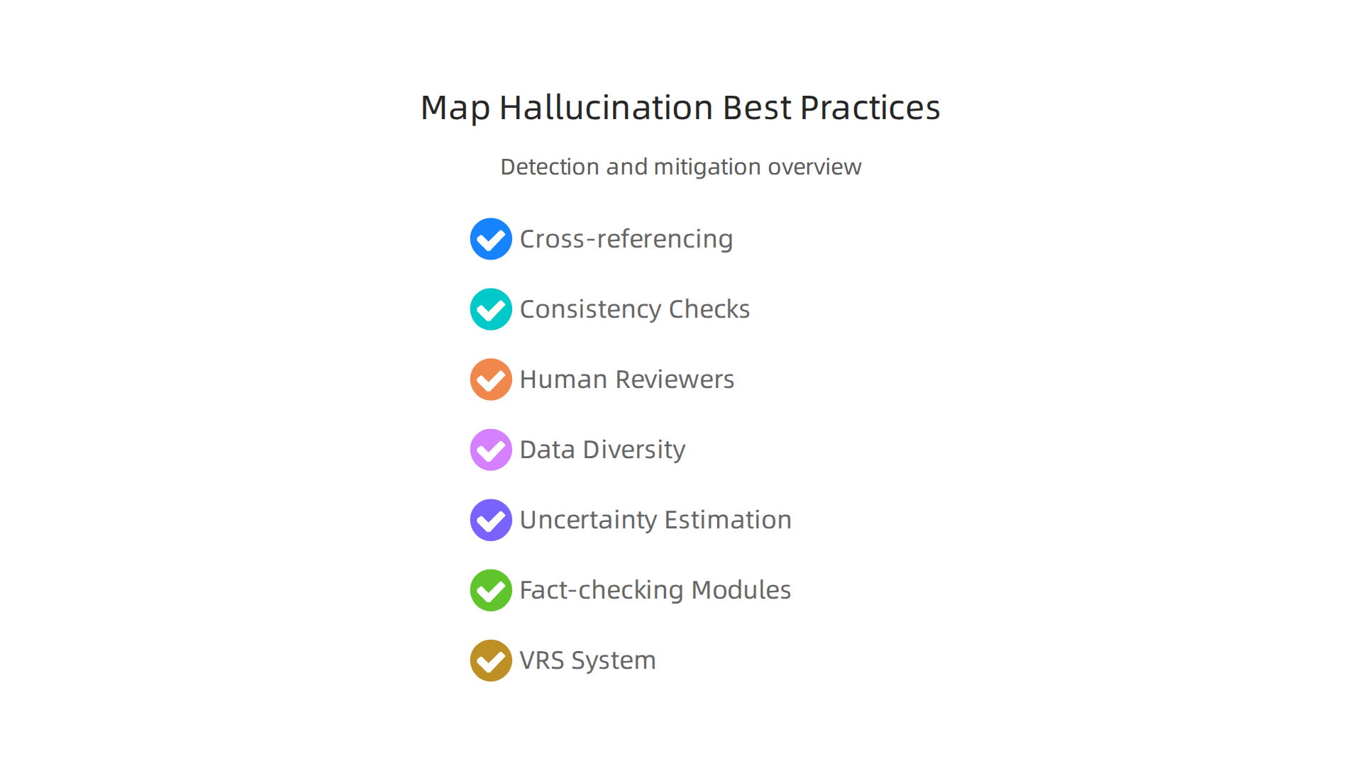
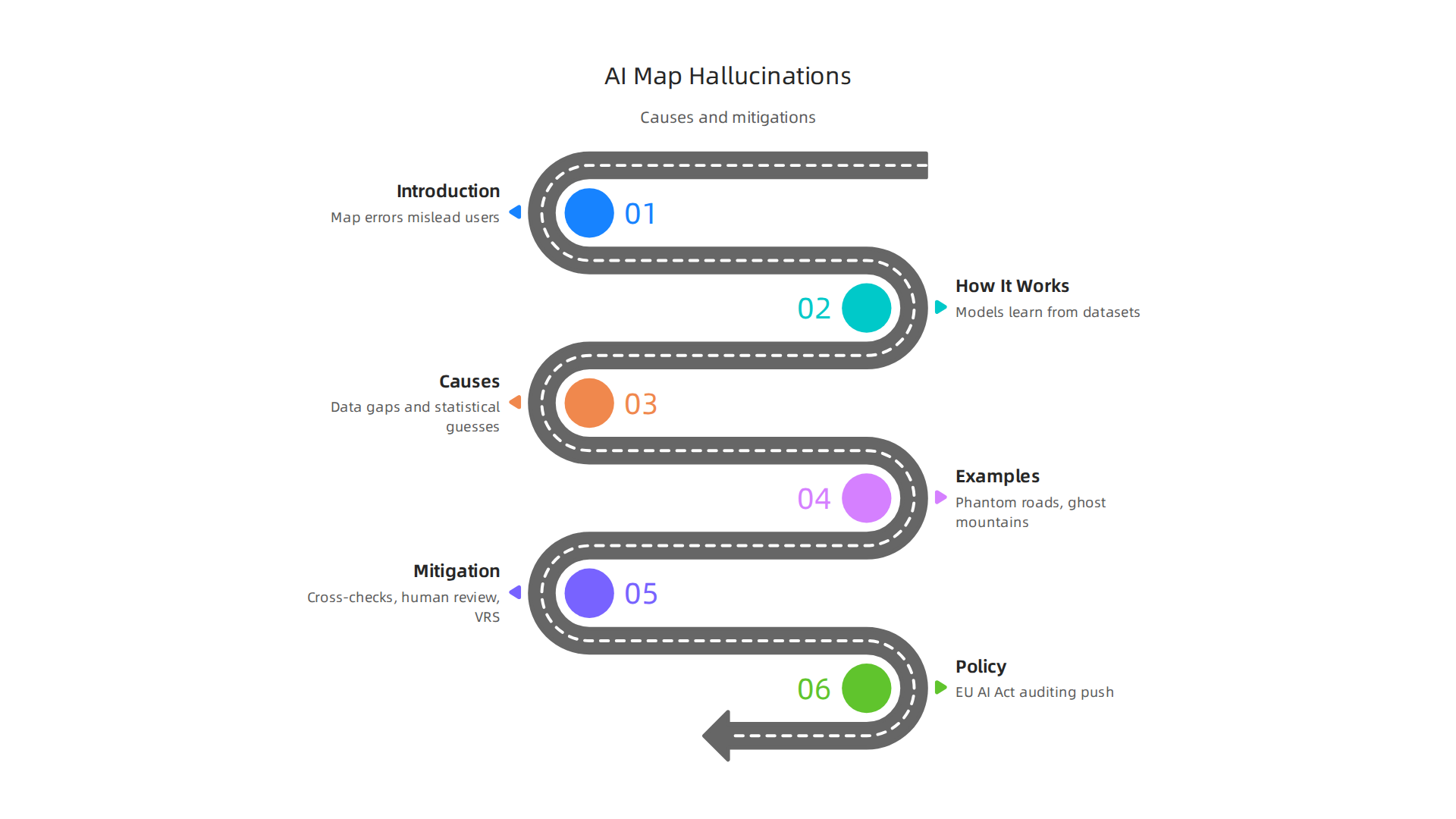
Detection starts with cross-referencing. Every feature a world map generator produces should be checked against trusted geospatial datasets like satellite imagery or government surveys. If a road appears in the AI map but does not exist in any official source, it is likely a hallucination. Another simple technique is consistency checks. Does a river flow uphill? Does a road connect two places that are far apart? These logical tests catch many obvious errors. Human reviewers still play a big role too. For critical maps used in navigation or planning, a person can quickly spot features that feel off. The LLM Hallucination Detection and Mitigation guide explains how these same principles apply to all types of AI models.
Mitigation strategies focus on preventing hallucinations in the first place. One effective approach is improving training data diversity. If a model has seen enough examples of different landscapes, it is less likely to guess incorrectly in unfamiliar terrain. Another method is uncertainty estimation. The model can learn to flag areas where it has low confidence, so those spots get extra review instead of being blindly accepted. Fact-checking modules add another layer by comparing each generated feature against a database of known geography.
One of the most promising solutions is a permission-based architecture called the Value Reinforcement System. Instead of letting the AI fill data gaps with guesses, this system only accepts map features that have a verified real-world source. It acts like a guardrail, stopping hallucinations at the source. The CRISP-DM and Skylab USA white paper documents the data methodology behind this kind of permission-based capture.
If you want to learn more about catching these errors in your own projects, check out this guide on how to detect AI hallucinations and stop costly mistakes. It covers tools and workflows that work for both text and map generators. Building trustworthy maps is possible, but it takes the right combination of detection, mitigation, and solid design.
Implications for Trust, Safety, and Policy in AI-Generated Maps
Building trustworthy maps is possible, but the stakes go far beyond just technical fixes. When a world map generator produces fake features, the real world consequences can be serious. A false road might not just confuse a driver — it could send emergency responders down a dead end. Infrastructure planners could build bridges or pipelines based on non-existent terrain. And in autonomous vehicles, a hallucinated lane could cause a crash.
A single incorrect driving distance between two points can already throw off navigation apps. If a world map generator invents a shortcut that does not exist, the estimated travel time is wrong. People trust these numbers, and that trust gets broken when the AI is wrong. As explained in this report on how AI hallucinations in maps create fake roads and endanger lives, the risks touch everything from personal safety to public infrastructure.
Policymakers are starting to take notice. The European Union’s AI Act sets strict rules for high-risk AI systems, including geospatial models.

Developers must analyze foreseeable risks, document their methods, and prove their maps are accurate. A deep look at the EU AI Act’s approach to GeoAI auditing shows how these rules push companies to build more reliable world map generators. Similar efforts are emerging in other regions, but enforcement is still catching up to the technology.
Rules alone are not enough though. Building trust requires both technical fixes and organizational accountability. Take the Value Reinforcement System mentioned earlier. This permission based architecture stops hallucinations at the source by only accepting map features with verified real-world data. That kind of design goes beyond detection — it prevents errors before they happen. If you want to see how this approach works in practice, you can review the VRS Patent 12,205,176 for the full technical details.
The bottom line is this: a world map generator is only as trustworthy as the systems behind it. Technical safeguards, human oversight, and smart regulations all have to work together. Without that combination, AI maps will keep inventing things that are not there. And when maps lie, people get lost — or worse.
Summary
AI-powered world map generators can produce realistic but false geographic features — phantom roads, invented lakes, ghost mountains, and even non-existent islands — because the models fill gaps in training data with statistically likely guesses. This article explains why those hallucinations happen, shows real-world examples and costs, and describes how faulty maps can corrupt routing and driving-distance calculations. It walks through the mechanics of generative map models, the role of data gaps and biased training sets, and practical detection methods like cross-referencing official imagery, consistency checks, and confidence flags. You will also learn mitigation techniques — better training data, uncertainty estimation, human review — and a permission-based approach embodied in the Value Reinforcement System (VRS) to stop fabrications at the source. The piece closes by discussing the wider trust, safety, and regulatory implications and gives actionable steps to reduce risk before deploying AI maps in the real world.