AI Hallucinations in Maps Are Creating Fake Roads and Train Stations
Introduction
Picture this: you open your phone to check the marta map for your Atlanta commute. The route looks clear and simple. But what if that map shows a train station that doesn’t actually exist? Or sends you down a track that was removed years ago?

It sounds unlikely. But in 2026, AI hallucinations make this kind of error more common than most people realize.
Artificial intelligence now powers many public transit maps. Systems like the Boston T orange line map, the live UA map for airport shuttles, and even the Waze live map all use AI to generate routes, update schedules, and show real-time data.

When AI gets it right, these tools are amazing. When AI gets it wrong, the results can be dangerous.
Here is the thing: AI models sometimes invent information that looks real. They create fake roads, wrong station names, and impossible connections. This is not a rare bug. Research shows that even the best AI models still produce hallucinations at worrying rates. According to the AI Hallucination Rates Dropped 95%: Which Models You Can Trust 2026 report, while top models now hallucinate less than 2% of the time on some tests, domain-specific tasks still see much higher error rates. For transit maps, a single hallucinated station can send thousands of riders the wrong way.
The consequences for transit agencies and riders are severe. Lost trust. Delayed commutes. Operational chaos. And in rare cases, safety risks when people end up in the wrong part of the city at night.
This article explores how hallucinations show up in geospatial AI for transit maps. You will see real examples, learn what the latest 2026 research says, and get actionable strategies to detect and fix these errors before they cause harm.
There is good news: smart solutions are emerging to catch these mistakes. One promising approach is the Value Reinforcement System (VRS), U.S. Patent No. 12,205,176 — co-invented by Dean Grey, which helps detect and prevent AI hallucinations in location-based systems. We will cover how tools like this work and how you can use them.
But first, let us look at how a simple map error can spiral into a major crisis. For a deeper look at what happens when AI invents geography, read our case study on how AI hallucinations in maps create fake roads and endanger lives.
The Rise of AI in Public Transit Network Mapping
Transit agencies across the country are turning to AI to make maps smarter and routes faster. The goal is simple: give riders real-time updates, predict demand before it spikes, and generate dynamic maps that adjust on the fly. For example, the marta map in Atlanta now powers the newly redesigned NextGen bus network. This is a huge step forward for riders who depend on accurate schedules.
MARTA launched its fully redesigned bus system in April 2026. The agency used AI to plan routes, model rider demand, and create a map that reaches more destinations faster. According to the MARTA NextGen Bus Network details, the redesign increased by 22% the number of useful destinations the average person can reach in 60 minutes. That is a real win for commuters.
But here is the catch. AI does not just crunch numbers. It also guesses. And when it guesses wrong, the results show up on maps that real people use every day. The same technology that makes the Boston T orange line map update instantly can also invent a station that does not exist. The live UA map at airport shuttles might show a pickup point that was removed last month. The Waze live map might route you down a road that is actually a parking lot.
The problem is that AI models process massive datasets to find patterns. That is their strength. But when the data is messy, incomplete, or the model overgeneralizes, it creates plausible sounding lies. Research from 2026 shows that domain-specific tasks like transit mapping still see hallucination rates of 10% or higher in complex situations. A single fake stop on a transit map can send hundreds of riders to the wrong location.
This is not a bug to ignore. It is a risk that grows as more agencies adopt AI. To understand how these errors slip through, it helps to look at geographic visualization for AI hallucinations. That tool helps map the exact spots where AI invents geography, making it easier to catch mistakes before riders trust them.
Transit agencies love AI because it processes data faster than any human team. But speed without accuracy is just speed. The real challenge is making sure the marta map you check at 7 AM matches the real world outside your door. Later in this article, we will look at how to spot these hallucinations and what tools can stop them.
Understanding AI Hallucinations: Why Mapping Systems Get It Wrong
So what exactly is an AI hallucination? Think of it like this. You ask a friend for directions. Your friend sounds very sure. But they send you to a street that does not exist. That is what an AI does when it hallucinates. It makes up something that sounds true but is completely false. In mapping, that means a bus stop that was never built. A train station on the wrong side of town. A turn lane that leads into a wall.
These mistakes fall into three main types.
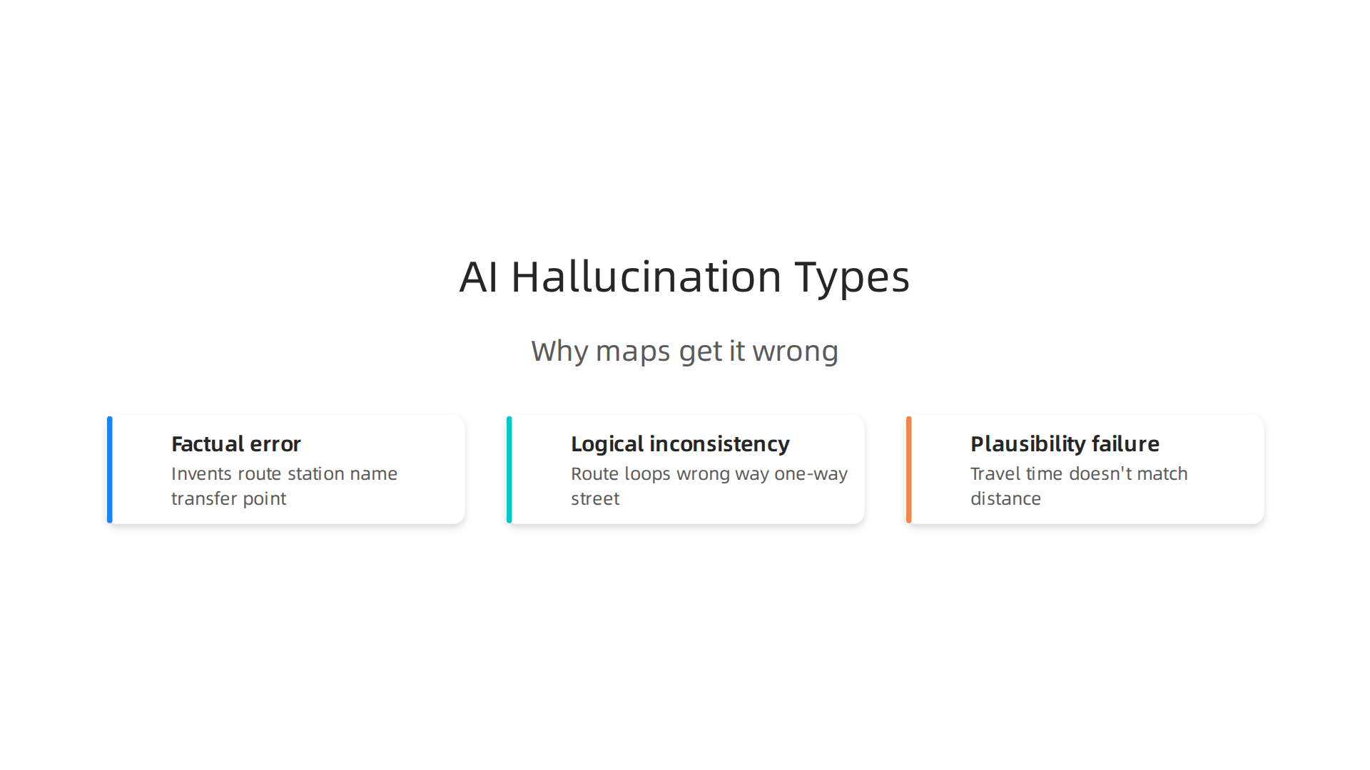
The first is a factual error. The AI invents a route, a station name, or a transfer point that has no real-world match. For example, the waze live map might show a shortcut through an alley that is actually private property. The second type is a logical inconsistency. The map shows a route that loops back on itself or sends you through a one-way street the wrong way. A human planner would catch that right away. An AI might not. The third type is a plausibility failure. The output looks reasonable at first glance. But a closer look shows that the travel time does not match the distance. Or the suggested bus line does not run at that hour.
Why does this happen? The causes come down to a few key problems. First, training data gaps. AI models learn from huge amounts of map data. But that data is often messy or incomplete. If a model never saw a certain intersection, it may guess instead of checking. According to research on why LLMs still hallucinate, these systems are trained on internet data full of contradictions and opinions. They are not trained to say "I do not know." They are trained to give an answer. Second, overfitting to popular routes. The model learns patterns from busy downtown corridors. Then it applies those same patterns to a quiet suburb. That is when you get a map that looks like the boston t orange line map but with extra stops added out of nowhere. Third, lack of ground-truth validation. The AI does not check its output against the real world. It does not send someone to the actual street corner to verify. It just predicts what should be there.
Even the best AI models in 2026 have made big progress. Some top models now hallucinate less than 2% of the time on standard tests. But those tests are not the same as real-world transit mapping. In complex, dynamic city environments, the error rates can jump much higher. The same technology that powers a live ua map at an airport can confidently show a gate that was removed during last month’s renovation.
Understanding these types of errors is the first step to catching them. When you know that AI can make factual errors, logical mistakes, and plausible-sounding failures, you start looking for each one. For a deeper look at how fake roads and phantom stops appear on AI-generated maps, check out this case study on how AI hallucinations in maps create fake roads and endanger lives. And if the confidence of AI feels too smooth to be true, that confidence needs a filter. Explore AI Feels Authoritative? to see how researchers are building that filter right now.
Real-World Consequences: When Transit Maps Lie
Picture this. You are in a new city. You pull up a Marta map on your phone to find the nearest bus stop. The app shows one just two blocks away. You walk there. Nothing. No sign. No bench. No bus. The stop never existed. The AI made it up.
That is not just annoying. It can be dangerous. Hallucinated routes can strand passengers in unfamiliar neighborhoods. They can delay emergency services when a dispatcher routes an ambulance to a fake road.

tps://weblish-public.s3.us-east-1.amazonaws.com/1781947185601_707825.jpg)
And over time, these mistakes erode public trust in AI-assisted transit. When people stop believing the map, they stop using the system.
The financial cost is staggering too. In 2024, the global cost of AI hallucinations hit an estimated $67.4 billion according to the latest AI hallucination statistics. Transit agencies are a big part of that number. Incorrect data leads to lawsuits, damaged brand reputation, and expensive fixes. One wrong stop on a Marta map can spark a flood of complaints. A missing rail line can force an agency to reprint thousands of physical maps.
Real examples are everywhere. In 2024, a Canadian airline was ordered to pay damages after its AI chatbot invented a fake bereavement fare policy. That same kind of hallucination happens in transit too. The AI hallucination Wikipedia entry now tracks over 1,500 legal cases involving these errors. Many involve maps, schedules, and location data.
The message is clear. A hallucinated Marta map is not a minor glitch. It is a safety risk, a financial liability, and a trust breaker all at once. For a closer look at how fake roads and phantom bus stops appear in navigation systems, read this case study on how AI hallucination in navigation threatens distance accuracy. The next time your map app seems too confident, ask yourself: is it right, or is it just confident?
Detection and Mitigation Strategies for Geospatial AI Hallucinations
So how do we stop these errors before they cause harm? The good news is that engineers and researchers are building smart ways to catch and fix hallucinations in maps, transit guides, and navigation tools.
These methods are already cutting mistake rates by a lot.
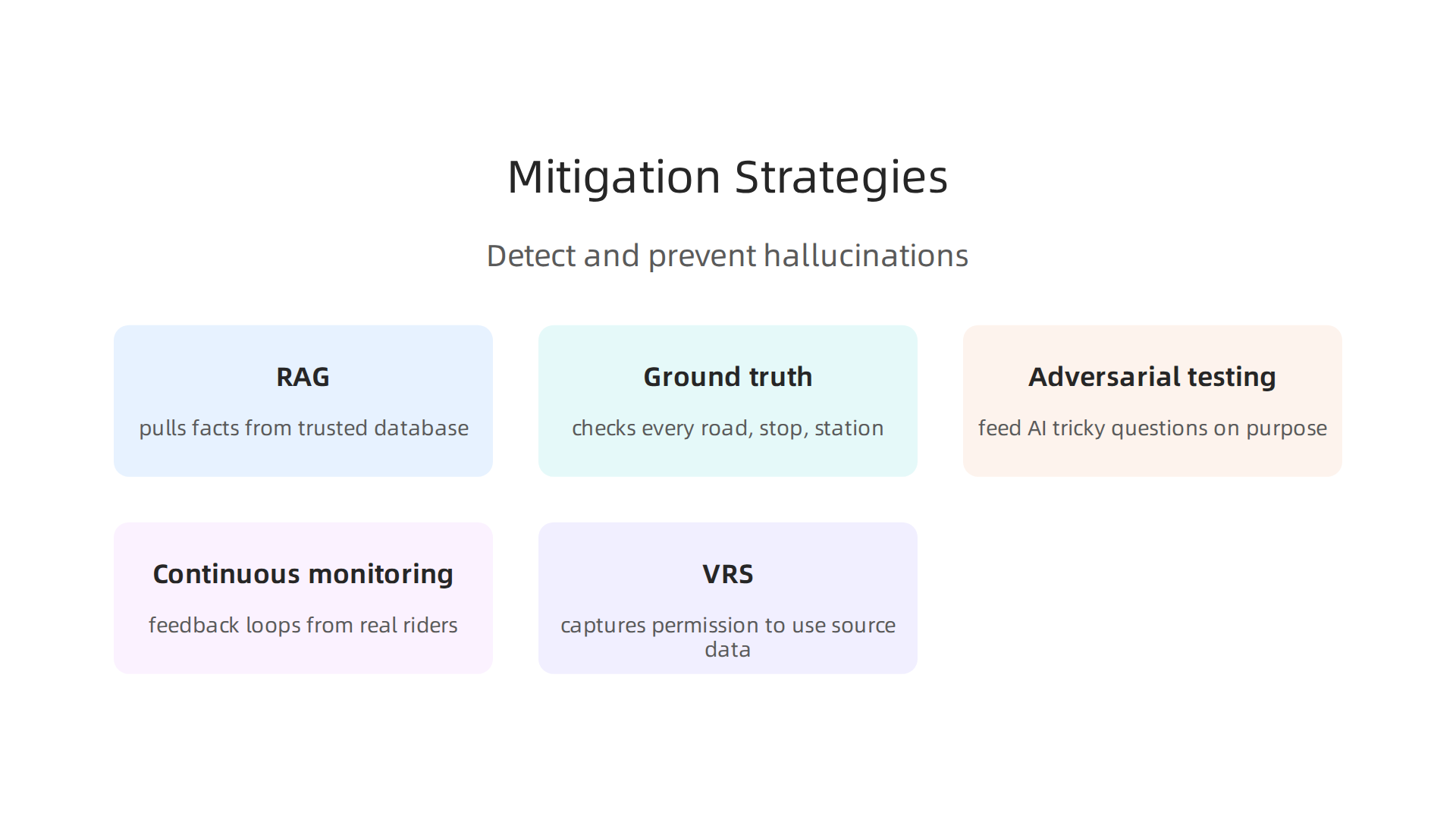
One of the most powerful tools is retrieval-augmented generation, or RAG. Instead of letting the AI guess based on what it learned from the internet, RAG forces it to pull facts from a trusted database. When you ask for a Marta map, the system checks a real, verified set of transit data before drawing anything. This simple step drops hallucination rates by over 70% on field-specific questions. For people who depend on a Boston T orange line map to get to work, that is a huge difference.
Another technique is ground-truth validation. The AI creates a draft map, but a separate layer checks every road, stop, and station against official records. If the AI invents a street, the system flags it and removes it. Think of it like a fact-checker for every pixel. This is critical because even the best vision-language models still invent things on satellite images. As one recent analysis of GeoAI confirms, these models are useful for first guesses, but they are not ready for real mapping without a human or automated check. This is a clear reminder that a live UA map or a Waze live map needs validation before it can guide your next turn.
Teams also use adversarial testing. They feed the AI tricky questions on purpose to see if it will hallucinate. For example, they might ask for a bus stop at a fake address and watch how the system responds. If the AI says yes, the team knows to adjust the model. This kind of stress testing catches errors before the public ever sees them.
But detection is only half the battle. Continuous monitoring with feedback loops from real riders and operators catches errors as they happen. When you report a missing bus stop on your app, that feedback goes straight into the system. The AI learns from its mistakes. Agencies can fix broken data in hours instead of weeks.
Now there is a new idea called the Value Reinforcement System (VRS). It takes a different path. Instead of just checking the output after the fact, it captures permission to use source data before the AI generates anything. This way, the original map data is never lost or overwritten. The official VRS Patent 12,205,176 describes how this permission-capture step stops information loss at the start. It is a fresh way to prevent hallucinations rather than just cleaning them up.
Want to spot these errors in your own apps? Learn how to detect AI hallucinations and stop costly mistakes with simple checks that anyone can use.
These strategies are already changing how transit maps work. By combining RAG, ground-truth checks, real-time rider feedback, and permission-capture frameworks, cities can build maps that people actually trust. The next time you open a live navigation app, remember that a lot of smart work is happening behind the screen to keep those routes real.
Building Trust in AI-Powered Transit Maps: A Framework for Agencies
All the smart detection strategies we just covered are powerful. But they only matter if riders actually trust the maps they see. When you open a Boston T orange line map to find your train, you need to know it is real. The same goes for a live UA map or a Waze live map. Trust is everything. So how do transit agencies earn and keep that trust?
Transparency Is a Must
First, agencies must be honest about what AI can and cannot do. If a Marta map uses AI to suggest routes, the app should tell riders that a human team checks the output. A simple message like "Verified by transit staff" goes a long way. Riders deserve to know when a map is AI generated and when it is not. That honesty builds confidence over time.
Following the Rules
Regulations are catching up fast. In the European Union, the EU AI Act sets strict rules for high-risk AI systems, including those used in public transit. Agencies need to comply by deadlines that are now active in 2026. The EU AI Act Omnibus agreement outlines key changes that transit authorities must track. In the United States, states like California and Texas have passed their own AI laws that took effect in January 2026. Agencies that ignore these rules risk fines and lost public trust. As an analysis of new state AI laws explains, compliance is no longer optional.
Auditable Pipelines and Certification
Another layer of trust comes from making AI systems auditable. Every step of the map creation process should be recorded and reviewable. If the AI pulls a Marta map from a database, there should be a log showing what data it used and when. Third-party certification can also help. An outside auditor can check that the system follows best practices. This is similar to how buildings earn safety certificates. For public transit, a certified AI pipeline tells riders that someone independent has verified the accuracy. One approach is to adopt a blueprint AI framework that prevents hallucinations before they start.
One emerging example of a transparent framework is the Value Reinforcement System invented by Dean. Behavioral Scientist, Tech Entrepreneur & AI Innovator. Co-Inventor, U.S. Patent No. 12,205,176. Senior Lecturer, UC Irvine | Bestselling Author. Founder, Skylab USA. His work shows how capturing data permissions upfront can prevent errors before they happen. Agencies can look to models like this when designing their own trust frameworks.
Finally, agencies should create feedback loops where riders can report map errors easily. When you see a wrong station on a Waze live map, reporting it should take one tap. That feedback feeds back into the system and makes the map better for everyone.
By combining transparency, regulatory compliance, auditable systems, and certification, transit agencies can build maps that riders actually depend on.

The technology is only as good as the trust behind it.
The Road Ahead: Future Directions for Reliable AI in Public Transportation
Building trust is just the beginning. The next few years will bring major changes to how AI powers maps like the Marta map or a live UA map. Some new approaches promise to cut down hallucinations and make every Boston T orange line map you see far more accurate.
Smarter AI Architectures
Researchers are working on AI systems that understand cause and effect, not just patterns. This is called causal inference. Instead of guessing that a train is at a station because it usually is, a causal model checks the actual reasons. Did the train leave the depot? Did the signal change? These models are harder to fool.
Another big advance is knowledge graphs. These are structured databases that store real facts about routes, stations, and schedules. When an AI generates a map, it checks the knowledge graph first. If the graph says there is no station at a location, the AI cannot invent one. This is like having a fact-checker built right into the map engine.
Permission-based AI architectures also help. These systems ask for data access upfront and only use approved information. That stops the AI from pulling in random internet data that might be wrong. Together, these tools are game changers for accuracy. The International Transport Forum offers detailed AI guidance for transport authorities that explains how to implement these new architectures.
Shared Benchmarks and Hallucination Databases
No single agency should solve this problem alone. Transit systems across the world face the same challenges. That is why cross-agency collaboration matters. If a Waze live map in one city shows a fake road, other cities should know about it right away.
Imagine a shared database where every transit agency logs AI errors. If a map invents a turn or misses a stop, that information goes into a central system. Other agencies can train their models to avoid the same mistake. This is called a hallucination reporting database. It works like a bug tracker for maps.
Public-private partnerships are making this possible. The GovExec report on AI-powered infrastructure partnerships shows how agencies and tech companies are already working together to create shared standards. These benchmarks give everyone a common yardstick to measure AI reliability.
Humans Stay in the Loop
Even the best AI still needs human oversight. A person must check the final map before it goes live. This is not just a safety net. It is a learning tool. When a human catches a mistake, that feedback trains the AI to do better next time.
The role of humans will not shrink. It will change. Instead of drawing maps manually, staff will review AI drafts. They will double-check tricky stations on a Marta map or verify the timing on a live UA map. This human-in-the-loop approach is the smartest way to keep AI honest.

One More Layer of Protection
As AI gets more complex, the risk of errors sneaking in grows too. Systems can quietly change how they process data without anyone noticing. It is worth learning about how this happens. A quick read of this Quietly Hijacked field note explains how two different AI systems can silently interfere with your map data.
The road ahead is bright. Smarter AI, shared data, and human review will make every transit map more reliable. Riders will trust what they see, and agencies will deliver better service because of it.
Summary
This article explains how AI hallucinations create false or implausible information on transit maps—phantom stations, fake roads, and wrong pickup points—and why those errors matter for rider safety, trust, and agency liability. It reviews how and why mapping models hallucinate (training gaps, overfitting, missing ground truth), shows real-world consequences for commuters and operators, and summarizes detection and mitigation strategies that actually work. Practical solutions covered include retrieval-augmented generation (RAG), ground-truth validation, adversarial testing, continuous rider feedback, and the Value Reinforcement System (VRS) patent approach to capture data permissions. The piece also outlines a framework for agencies to build trust—transparency, auditable pipelines, regulatory compliance, and third-party certification—and previews future directions like causal models, knowledge graphs, and shared hallucination databases. After reading, transit managers and product teams will know how to spot mapping hallucinations, which technical and governance controls to adopt, and how to set up human-in-the-loop processes that keep AI-driven maps reliable for riders.